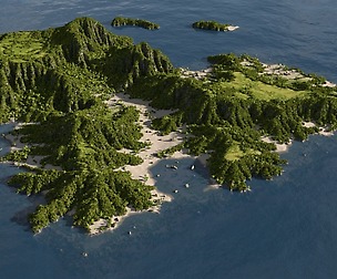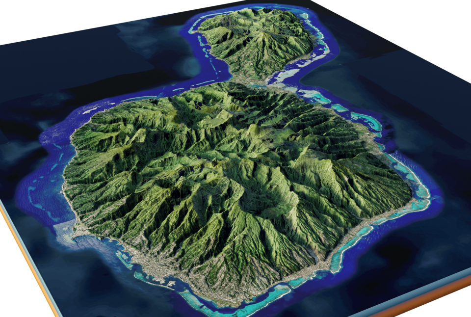
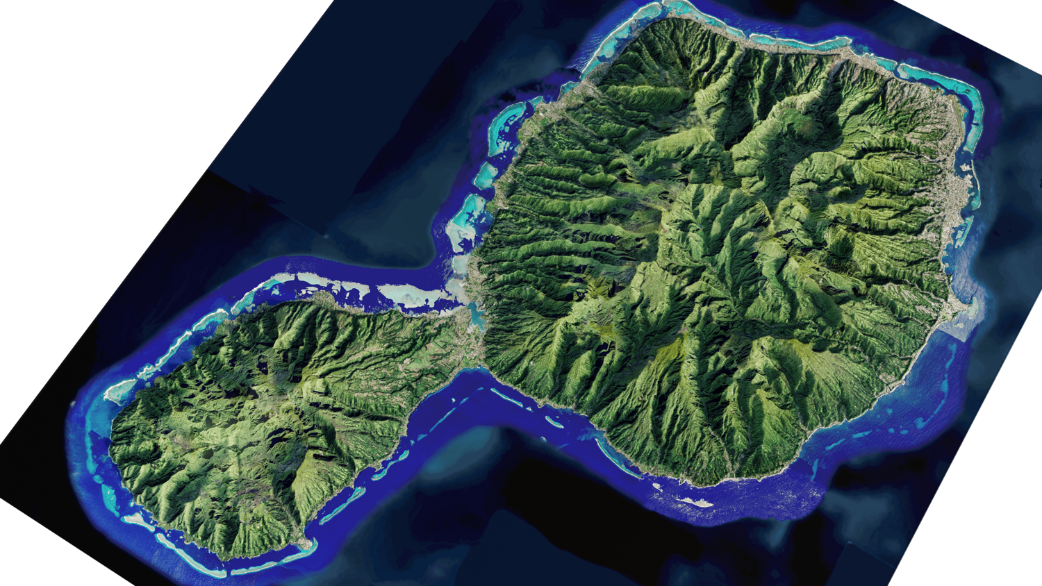


Tahiti island full 3d model terrain
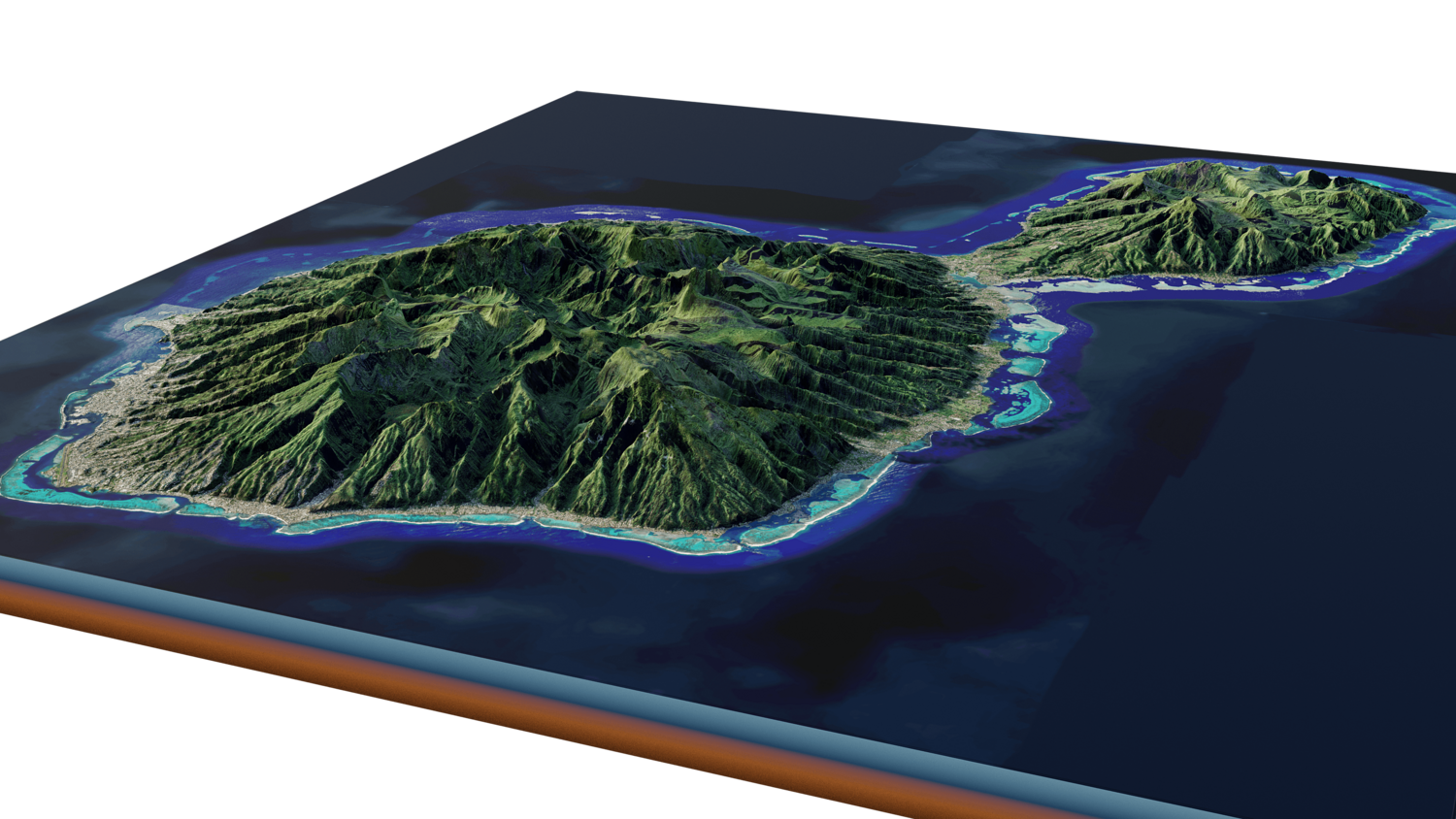
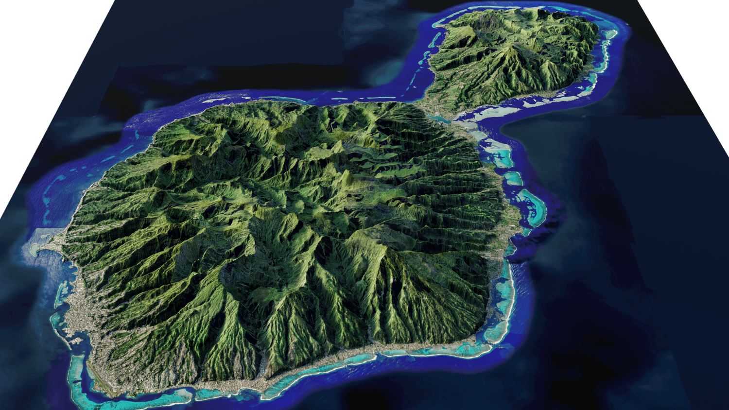
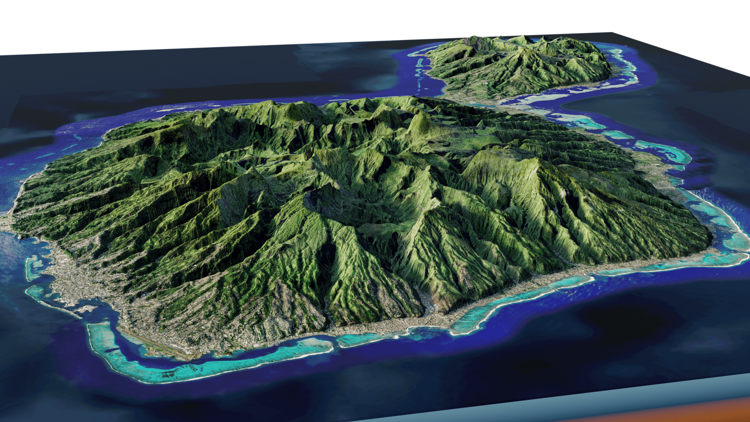
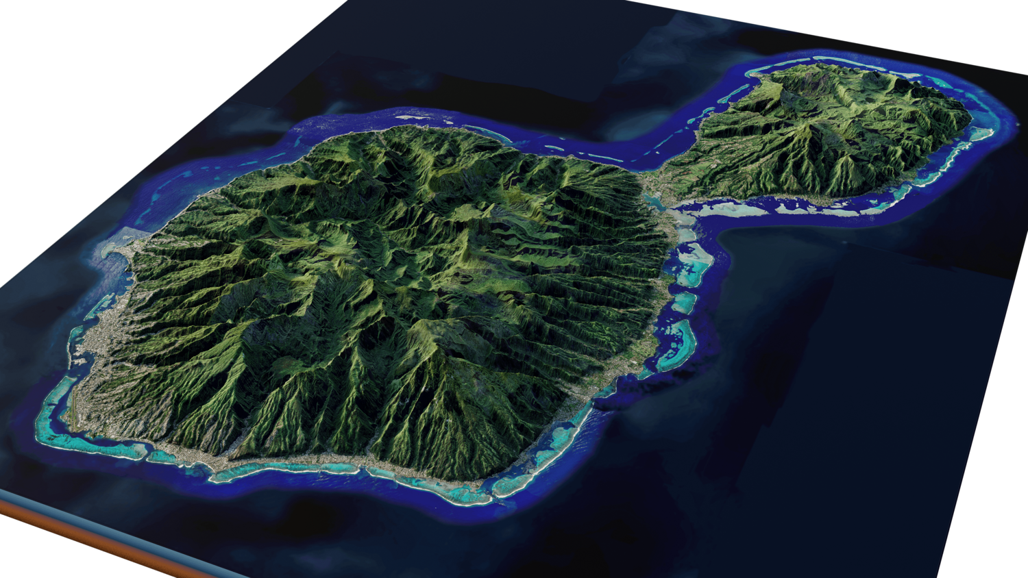
Tahiti island full 3d model terrain. 3d model landscape of the island of Tahiti with its cityscape, landscape of mountains, beaches and forests
Tahiti island full 3d model terrain, Tahiti, French Polynesia, France
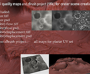
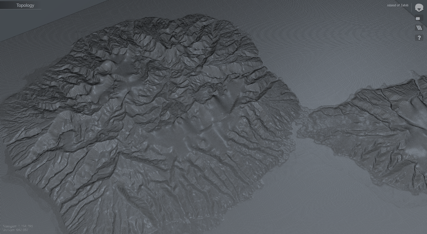
High Poly mesh High detailed model
with 13K textures - Diffuse map - AO map -Displacement map -Normal map -Roughness map
The Blend file do not require the displacement, but you can still use it if you want to create other island model yourself
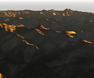
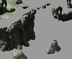
texture example from the Tahiti island, Tahiti, French Polynesia, French. Tahiti is the largest island in French Polynesia, the South Pacific archipelago. Shaped like a figure-8, it's divided into Tahiti Nui (the larger, western section) and Tahiti Iti (the eastern peninsula). the island was formed from volcanic activity, it is high and mountainous with surrounding coral reefs. Island highest peak is Mont Orohena. Mount Orohena is not only the highest peak in Tahiti, it is the highest in the whole of French Polynesia.
Model Details
- FormatsOBJ, STL, FBX, BLEND
- Polygons580577
- Vertices582097
- animatedno
- materialsno
- texturesno
- riggedno
- uvsyes
- 3d print readyno
You will get 5 files
All files previously purchased will always be available for download in your Library